Pollutant:

Plot type: Concentration

Threshold:

Colormap* colormap
* Grey shaded area shows total atmospheric aerosol plume
Forecast Information:

Date:
Cycle:
Vertical Level: 0 - 100 m (AGL) average
Initial Boundary Conditions: NAM NEST Hawaii Meteorology: WRF v4.3
SO2 Emission Rate (Kilauea):
SO2 Emission Rate (Mauna Loa): below detection limit
Completion Timestamp:


About This Map: The VMAP Vog Forecast Dashboard displays information on near-surface air quality from volcanic gas emissions. The VMAP forecasts are intended to (1) provide guidance on the location/envelope of the vog plume; and (2) provide guidance on the locations of possible health risks for general public, as defined by the EPA. All products, data and graphics provided on the VMAP website are for general information purposes only. Default animation controls are displayed in viewer's local time.


Select locations to add to map display.


SO2 Monitoring Stations:


Last updated: N/A

Last updated: N/A


Locations of Interest:


Disclaimer: The observed conditions at the stations are the last measurement values received only, as available from the individual data providers. Be certain to check timestamps. The University of Hawai'i and the VMAP program do not operate these sensors. The displayed values are not modeled predictions. More information can be found on the Hawaii State Department of Health website.


There are no active alerts at this time.

The most current SO2 emission rate provided by the HVO is .


Please click/tap on questions below to learn about health impacts of vog.

Vog is a term that refers to volcanic smog. It is the haze you may see in the air that is caused by a combination of weather, wind conditions and volcanic activity. Vog becomes thicker or lighter depending upon the amount of emissions from Kilauea volcano, the direction and amount of wind, and other weather conditions. More information can be found here.


Vog is primarily a mixture of sulfur dioxide (SO2) gas and sulfate (SO4) aerosol. SO2 (invisible) reacts with oxygen and moisture in the air to produce SO4 aerosol (visible). Sulfate aerosols are very small particles consisting of particulate matter less than 2.5 micrometers in diameter and are referred to as PM2.5. Other sources of PM2.5 include vehicle exhaust and smoke from fires. Vog contains mostly SO2 and PM2.5, in contrast to urban, industrial, and other pollution sources, which also contain additional toxic contaminants, such as ozone and hydrocarbons. More information can be found here.


Health effects from vog will vary depending on the amount of vog present and an individual’s susceptibility. People most likely to experience negative health effects from vog include:

  • people with asthma or other respiratory conditions
  • people with cardiovascular disease
  • older adults
  • infants and children
  • new or expectant mothers
Short-term exposure to elevated levels of SO2 can cause symptoms such as irritation of the eyes, nose, throat and skin, coughing, wheezing, chest tightness, and difficulty breathing. Some people also report fatigue and/or dizziness.
Both long- and short-term particle (PM2.5) exposures have been linked to various health problems. In the short-term, exposure to high levels of PM2.5 may cause eye, nose and throat irritation, as well as coughing, phlegm production, chest tightness and shortness of breath. Long term exposure to elevated levels of PM2.5 from industrial pollution has been associated with worsening of chronic respiratory and cardiovascular diseases and may cause reproductive and developmental harm.

For more information please visit IVHHN Vog Dashboard, EPA, and American Lung Association


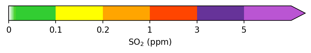
Vog conditions can change rapidly due to changes in winds, weather and volcanic activity. Because conditions can change quickly, it is important for people living in and visiting areas impacted by vog take steps to keep themselves safe. It is recommended that people in vog-impacted areas keep aware of conditions and get familiar with key air monitoring websites and the SO2 and PM2.5 advisory codes/levels.This information can be found here. If you are feeling symptoms that may be related to vog or are aware of high levels of vog in your area, the following recommendations may help protect you from vog:

  • Reduce outdoor activities that cause heavy breathing. Avoiding outdoor activity and exercise during vog conditions can reduce exposure and minimize health risks. This is especially important for sensitive groups such as children, the elderly, and individuals with pre-existing respiratory conditions including asthma, bronchitis, emphysema, and chronic lung and heart disease.
  • Stay indoors and close windows and doors. If an air conditioner is used, set it to recirculate.
  • If you need to move out of an impacted area, turn on the car’s air conditioner and set it to recirculate.
  • Take daily prescribed medication for respiratory illnesses and always keep medications on hand and readily available.
  • Remember that face coverings and masks used to prevent the spread of COVID-19 do not provide protection from SO₂ or vog.
  • Contact a doctor as soon as possible if any health problems develop and seek medical care right away if you have severe symptoms or difficulty breathing.
  • Do not smoke and avoid second-hand smoke.
  • Drink plenty of fluids to avoid dehydration.
  • Have family emergency plans prepared and ready.
  • Heed all warnings by county and state emergency management officials.
More information can be found here.


Menu Options

Click on Map Layers to switch between pollutants, plot types and air quality thresholds. This tab also provides information on forecast configuration, timing, and data sources.
Locations tab allows the user to toggle various points of intereset on the map. Select air quality monitoring stations to view the most recent observed SO2 readings.
Click to see the most recent Forecast Discussion and alerts.
Vog and Health tab provides information about the primary vog pollutants and their effects on human health. Click to learn about how to protect yourself from vog and minimize health risks.
Click to see this User Guide.
Contact from for submitting questions and feedback.
Link to Vog Measurement and Prediction (VMAP) Program Homepage.

Layer Controls

The following options can be found under the Map Layers tab:
Click to select which pollutant to display. SO2 and SO4 denote sulfur dioxide gas and sulfate aerosols, respectively. To learn more about these primary vog pollutants please visit Interagency Vog Dashboard.
Click to select what type of plot to display. Choose to show ensemble-averaged hourly concentrations and for probability of exceedance (POE) plots. The latter indicates how likely it is that surface concentrations at a given location will exceed an air quality threshold (see below).
Click to select an air quality threshold. This option only applies to POE plots. To learn more about National Ambient Air Quality Standards (NAAQS) please visit EPA's NAAQS Page.

Animation Controls

Use these controls to play, pause or step through forecast hours.
Drag slider to change animation speed.
Click to recenter the map.
Click to zoom in and out.


Please use the form below to submit questions, comments or feedback about this page.

Disclaimer: The information contained in the VMAP website is for general information purposes only. While we endeavor to keep the information accurate and up-to-date, we make no representations, warranties, or guarantees about the completeness, accuracy, reliability, suitability, or availability with respect to the VMAP website or the information, products, services, or related graphics contained on the VMAP website for any purpose. Although every effort is made to avoid interruptions to VMAP access, any reliance upon any information presented is strictly at your own risk. In no event will the University of Hawaii at Manoa, the UH-M Department of Atmospheric Sciences, the VMAP team, or any personnel or collaborator associated with VMAP be liable for any losses or damages (direct or indirect) without limitation whatsoever in connection with the use of the VMAP website. The general public is welcome to use the VMAP at this time and by its use implicitly agrees to the terms of this disclaimer.